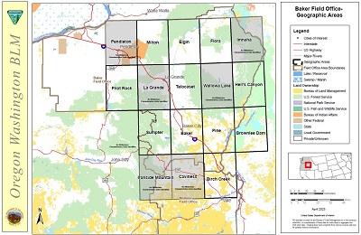
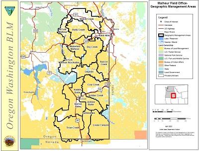
Vale District Wilderness Characteristics Inventories
The Vale District Bureau of Land Management initially completed our updated wilderness characteristics inventory in 2012 and subsequently finalized a reassessment of our determinations in 2017. The inventory update evaluated all BLM-administered lands in the District—outside of existing Wilderness Study Areas—to determine if they meet the wilderness characteristics inventory criteria of: size, naturalness, outstanding opportunities for solitude or primitive recreation, and supplemental values. The results of the inventory update are provided below by geographic area within each Field Office. Select the area of interest and launch (or download) the specific inventory unit analysis, maps and the BLM’s final determination.
Baker Field Office
A full size map of Baker Geographic Management Areas can be found at https://www.blm.gov/sites/default/files/docs/2023-06/Baker-GMA-map.pdf
- Baker
Inventory Units
If a Wilderness Inventory Unit is not yet listed, those findings have yet to be completed and will be posted in the future.
Baker GMA Map
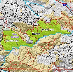
The map above is a cropped version. Here is the complete map with legend.
- Birch Creek
Inventory Units
If a Wilderness Inventory Unit is not yet listed, those findings have yet to be completed and will be posted in the future.
Birch Creek GMA Map
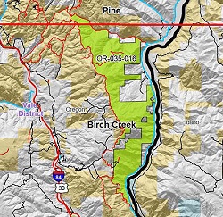
The map above is a cropped version. Here is the complete map with legend.
- Brownlee Dam
Inventory Units
If a Wilderness Inventory Unit is not yet listed, those findings have yet to be completed and will be posted in the future.
Brownlee Dam GMA Map
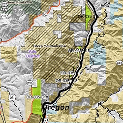
The map above is a cropped version. Here is the complete map with legend.
- Elgin
Inventory Units
If a Wilderness Inventory Unit is not yet listed, those findings have yet to be completed and will be posted in the future.
Elgin GMA Map
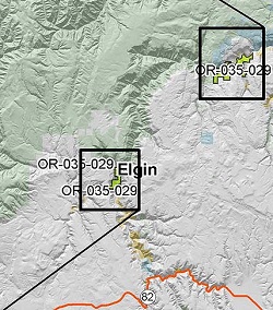
The map above is a cropped version. Here is the complete map with legend.
- Flora
Inventory Units
If a Wilderness Inventory Unit is not yet listed, those findings have yet to be completed and will be posted in the future.
Flora GMA Map
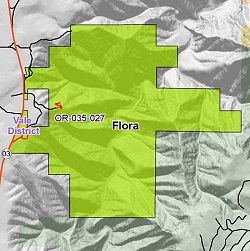
The map above is a cropped version. Here is the complete map with legend.
- Hells Canyon
Inventory Units
If a Wilderness Inventory Unit is not yet listed, those findings have yet to be completed and will be posted in the future.
- OR-035-019 Homestead Contiguous - All
- OR-035-020 McGraw Creek Contiguous - All
- OR-035-026 Dead Horse - All
Hells Canyon GMA Map
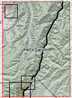
The map above is a cropped version. Here is the complete map with legend.
- Milton
Inventory Units
If a Wilderness Inventory Unit is not yet listed, those findings have yet to be completed and will be posted in the future.
Milton GMA Map
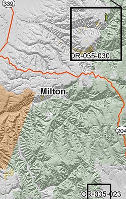
The map above is a cropped version. Here is the complete map with legend.
- Pilot Rock
Inventory Units
If a Wilderness Inventory Unit is not yet listed, those findings have yet to be completed and will be posted in the future.
Pilot Rock GMA Map
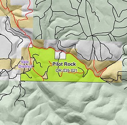
The map above is a cropped version. Here is the complete map with legend.
- Pine
Inventory Units
If a Wilderness Inventory Unit is not yet listed, those findings have yet to be completed and will be posted in the future.
Pine GMA Map
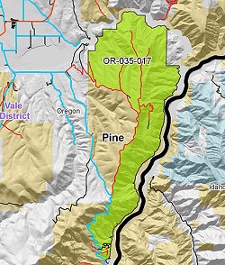
The map above is a cropped version. Here is the complete map with legend.
- Sumpter
Inventory Units
If a Wilderness Inventory Unit is not yet listed, those findings have yet to be completed and will be posted in the future.
Sumpter GMA Map
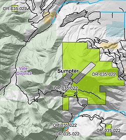
The map above is a cropped version. Here is the complete map with legend.
- Telocaset
Inventory Units
If a Wilderness Inventory Unit is not yet listed, those findings have yet to be completed and will be posted in the future.
Telocaset GMA Map
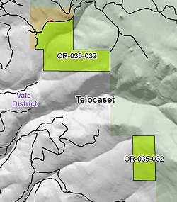
The map above is a cropped version. Here is the complete map with legend.
Malheur Field Office
In 2015, the Oregon State Director approved combining the Malheur and Jordan Resources Areas into the Malheur Field Office.
A full size map of Malheur Geographic Management Areas can be found at https://www.blm.gov/sites/default/files/docs/
- Barren Valley
Inventory Units
If a Wilderness Inventory Unit is not yet listed, those findings have yet to be completed and will be posted in the future.
- OR-036-020 Rye Grass - All
- OR-036-022 Flat Top Mountain - All
- OR-036-023 Tourist Court - All
- OR-036-025 Military Road - All
- OR-036-026 Red Hills - All
- OR-036-027 Sand Dunes - All
- OR-036-032 Cherry Well - All
- OR-036-040 Bedground Reservoir - All
- OR-036-072 Winter Range - All
- OR-036-073 Hardin - 2010
- OR-036-093 Alvord Desert Contiguous - 2010
Barren Valley GMA Map
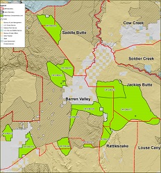
The map above is a cropped version. Here is the complete map with legend.
- Bully Creek
Inventory Units
If a Wilderness Inventory Unit is not yet listed, those findings have yet to be completed and will be posted in the future.
- OR-034-036 Indian Creek - All
- OR-034-037 South Cottonwood - All
- OR-034-038 Westfall Highlands - All
- OR-034-065 Willow Spring - All
- OR-034-078 Buckbrush Creek - All
- OR-034-079 Clover Creek - All
- OR-034-080 Long Gulch - All
- OR-034-081 Jenkins Reservoir - All
- OR-034-084 Cottonwood Creek - All
- OR-034-086 Lower Bully Creek - All
- OR-034-087 Swede Flat - All
- OR-034-088 Dahley Well - All
- OR-034-104 Bull Spring - All
Bully Creek GMA Map
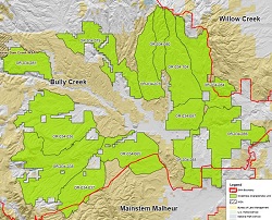
The map above is a cropped version. Here is the complete map with legend.
- Cow Creek
Inventory Units
If a Wilderness Inventory Unit is not yet listed, those findings have yet to be completed and will be posted in the future.
- OR-036-052 Lower Cow Lake - All
- OR-036-053 Deer Butte - All
- OR-036-057 Clarks Butte Contiguous - All
- OR-036-059 Bogus Rim - All
- OR-036-074 Arock - All
- OR-036-075 Indian Camp - All
- OR-036-077 Lower Owyhee Contiguous - All
- OR-036-081 Lava - All
- OR-036-082 Goodyear - All
- OR-036-083 Purser Ridge
- OR-036-092 Jordan Craters Contiguous - 2010
Cow Creek GMA Map
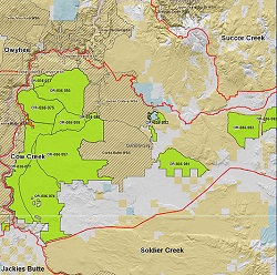
The map above is a cropped version. Here is the complete map with legend.
- Dry Creek
Inventory Units
If a Wilderness Inventory Unit is not yet listed, those findings have yet to be completed and will be posted in the future.
- OR-034-017 Deer Butte - All
- OR-034-022 Shell Rock Springs - All
- OR-034-023 Sand Hollow - All
- OR-034-024 Burnt Mountain - All
- OR-034-025 Cow Hollow - All
- OR-034-026 Rock Canyon - All
- OR-034-027 Broken Rim - All
- OR-034-028 Freezeout Ridge - All
- OR-034-029 Harper - All
- OR-034-030 Sourdough Mountain - All
- OR-034-034 Sq___ Creek - All
- OR-034-035 Keeney Creek - All
- OR-034-039 Hunter Spring - All
- OR-034-040 Double Mountain - All
- OR-034-045 Little Valley - All
- OR-034-046 Chalk Butte - All
- OR-034-047 Juniper Creek - All
- OR-034-048 Vines Hill - All
- OR-034-050 Schaeffer Butte - All
- OR-034-051 Quartz Mountain - All
- OR-034-052 Wallrock Ridge - All
- OR-034-053 McNulty - All
- OR-034-117 Dry Creek Buttes Contiguous
Dry Creek GMA Map
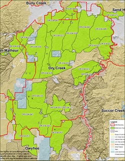
The map above is a cropped version. Here is the complete map with legend.
- Jackies Butte
Inventory Units
If a Wilderness Inventory Unit is not yet listed, those findings have yet to be completed and will be posted in the future.
- OR-036-016 Hanson Canyon - All
- OR-036-069 Big Grassy - All
- OR-036-072 Winter Range - All
- OR-036-073 Hardin - All
- OR-036-089 Smiths Well
Jackies Butte GMA Map
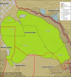
The map above is a cropped version. Here is the complete map with legend.
- Louse Canyon
Since 2007, when the Louse Canyon GMA portion of the BLM Wilderness Inventory maintenance was completed, a different document standardization process has been implemented. Therefore, these documents are being posted in both the new standard format and the 2007 maintenance format. No information, analysis, or data has changed, only formatting and appearance (minus the Rattlesnake Creek C - OR-036-017 inventory unit; see explanation).
Inventory Units
- OR-036-001 Starvation Spring
- OR-036-002 Twin Butte
- OR-036-003 Cairn C
- OR-036-004 Oregon Butte
- OR-036-005 Deer Flat
- OR-036-006 Tent Creek Cow Camp
- OR-036-007 Pole Creek
- OR-036-008 Black Butte
- OR-036-009 High Ridge A
- OR-036-010 Field Creek
- OR-036-011 Antelope Creek
- OR-036-012 Rawhide
- OR-036-013 Steer Canyon
- OR-036-014 Sacramento Hill
- OR-036-015 Coyote Wells
- OR-036-016 Hanson Canyon
- OR-036-017 Rattlesnake Creek C - After these 2007 forms were completed, the Rattlesnake GMA portion of the BLM Wilderness Inventory maintenance was initiated. As a result, the Rattlesnake Creek C - OR-036-017 inventory unit is now included within the current Rattlesnake Creek - OR-036-028 inventory unit to be evaluated as one. Please refer to the Rattlesnake GMA portion to review this data.
- OR-036-018 Five Points
Louse Canyon GMA Map
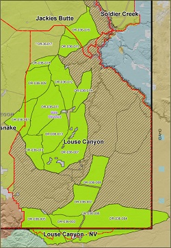
The map above is a cropped version. Here is the complete map with legend.
- Mainstem Malheur
Inventory Units
If a Wilderness Inventory Unit is not yet listed, those findings have yet to be completed and will be posted in the future.
- OR-034-031 Trail Creek - All
- OR-034-034 Sq___ Creek - All
- OR-034-042 Prava Peak - All
- OR-034-043 Rufino Butte - All
- OR-034-044 Hunter Creek - All
- OR-034-063 Hog Creek - All
- OR-034-064 Corbett Creek - All
- OR-034-119 Sperry Crk Contiguous - All
Mainstem Malheur GMA Map
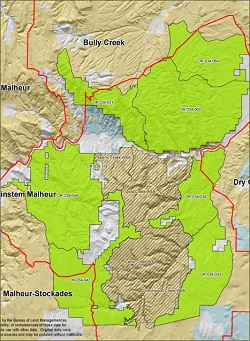
The map above is a cropped version. Here is the complete map with legend.
- North Fork Malheur
Inventory Units
If a Wilderness Inventory Unit is not yet listed, those findings have yet to be completed and will be posted in the future.
- OR-034-001 Agency Mountain - All
- OR-034-003 Northeast Lake Ridge - All
- OR-034-007 West Fork Bendire
- OR-034-010 Stemler Ridge - All
- OR-034-011 Mustang Basin - All
- OR-034-012 Dearmond Mountain - All
- OR-034-121 West River Breaks - All
- OR-02-16A Cottonwood Creek - All
- OR-02-17 Rocky Basin - All
- OR-02-20 Drinkwater - All
North Fork Malheur GMA Map
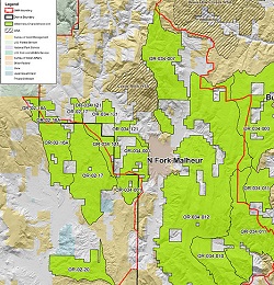
The map above is a cropped version. View complete map with legend.
- Owyhee
Inventory Units
If a Wilderness Inventory Unit is not yet listed, those findings have yet to be completed and will be posted in the future.
- OR-034-054 The Tongue - All
- OR-034-057 Schnable Creek - All
- OR-034-059 Rinehart Creek - All
- OR-034-060 Clark Ranch - All
- OR-034-061 Cold Spring - All
- OR-034-098 Table Mountain - All
- OR-034-099 McCain Springs - All
- OR-034-100 Wild Rose Reservoir - All
- OR-034-113 Blue Canyon Contiguous
- OR-034-115 Lower Owyhee Canyon
- OR-034-120 Saddle Butte Contiguous - All
Owyhee GMA Map
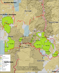
The map above is a cropped version. Here is the complete map with legend.
- Rattlesnake
Inventory Units
If a Wilderness Inventory Unit is not yet listed, those findings have yet to be completed and will be posted in the future.
- OR-036-028 Rattlesnake Creek - All
- OR-036-029 Deadhorse - All
- OR-036-030 Alcorta Rim - All
- OR-036-032 Cherry Well - All
Rattlesnake GMA Map
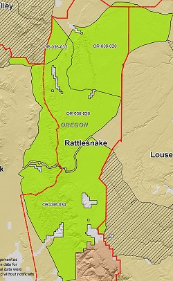
The map above is a cropped version. Here is the complete map with legend.
- Saddle Butte
Inventory Units
If a Wilderness Inventory Unit is not yet listed, those findings have yet to be completed and will be posted in the future.
Saddle Butte GMA Map
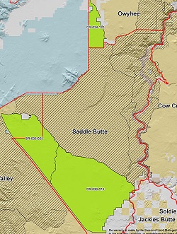
The map above is a cropped version. Here is the complete map with legend.
- Sand Hills
Inventory Units
If a Wilderness Inventory Unit is not yet listed, those findings have yet to be completed and will be posted in the future.
- OR-034-021 Black Jack Butte - All
- OR-034-089 Tub Mountain - All
- OR-034-090 Henrys Gulch - All
- OR-034-101 Pine Tree Ridge - All
Sand Hills GMA Map
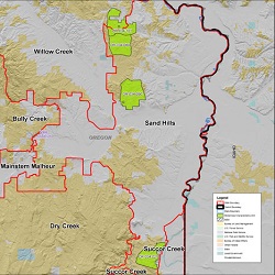
The map above is a cropped version. Here is the complete map with legend.
- Soldier Creek
Inventory Units
If a Wilderness Inventory Unit is not yet listed, those findings have yet to be completed and will be posted in the future.
- OR-036-054 Jaca Reservoir - All
- OR-036-055 Grenke - All
- OR-036-060 Wroten - All
- OR-036-061 Antelope Reservoir - All
- OR-036-062 Gluch - All
- OR-036-063 Black Butte - All
- OR-036-064 Parsnip - All
- OR-036-065 Round Mountain - All
- OR-036-066 Little John - All
- OR-036-067 Noon - All
- OR-036-068 Grassy - All
- OR-036-078 Monument Pass - All
- OR-036-079 Juniper Point - All
- OR-036-086 School House Gulch - This inventory
unit has yet to be converted to PDF - OR-036-091 Owyhee River Contiguous
- OR-036-095 Little Groundhog Reservoir - All
- OR-036-096 Castro Ridge - All
Soldier Creek GMA Map
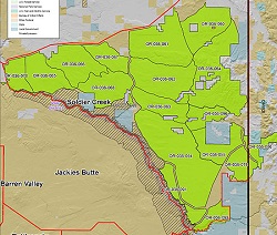
The map above is a cropped version. Here is the complete map with legend.
- South Fork Malheur
Inventory Units
If a Wilderness Inventory Unit is not yet listed, those findings have yet to be completed and will be posted in the future.
- OR-034-062 Star Mountain - All
- OR-034-066 Skull Sprs Reservoir - All
- OR-034-067 Roostercomb - All
- OR-034-068 Whiskey Jack Springs - All
- OR-034-069 Monuments - All
- OR-034-070 Duck Pond - All
- OR-034-071 Deadman Creek - All
- OR-034-073 Slaughter Gulch - All
- OR-034-075 Granite Creek - All
- OR-034-076 Hickey Basin Reservoir - All
- OR-034-077 Dry Buttes - All
- OR-034-091 Box Canyon - All
- OR-034-105 Black Butte - All
- OR-034-106 River - All
- OR-034-107 Selle Gap - All
- OR-06-02 Visher - All
South Fork Malheur GMA Map
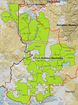
The map above is a cropped version. Here is the complete map with legend.
- Succor Creek
Inventory Units
If a Wilderness Inventory Unit is not yet listed, those findings have yet to be completed and will be posted in the future.
- OR-034-014 McIntyre Ridge
- OR-034-015 Board Corral Spring - All
- OR-034-016 Board Corral Mountain - All
- OR-034-018 Antelope Creek - All
- OR-034-019 Rookie Creek - All
- OR-034-032 Mahogany Mountain - All
- OR-034-055 Three Fingers Rock South - All
- OR-034-056 Three Fingers Rock North - All
- OR-034-058 Steamboat Ridge - All
- OR-034-092 Spanish Charlie Basin - All
- OR-034-093 McBride Creek - All
- OR-034-094 Smith Butte - All
- OR-034-095 Bannock Ridge - All
- OR-034-096 Spring Mountain - All
- OR-034-097 Wilson Creek - All
- OR-034-111 Dry Creek
- OR-034-112 Coal Mine Basin
- OR-034-116 Honeycomb Contiguous
- OR-034-118 Wildhorse Basin Contiguous
Succor Creek GMA Map
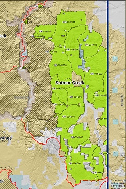
The map above is a cropped version. Here is the complete map with legend.
- Trout Creek
Inventory Units
If a Wilderness Inventory Unit is not yet listed, those findings have yet to be completed and will be posted in the future.
- OR-036-033 Long Ridge
- OR-036-035 Oregon Canyon Contiguous - All
- OR-036-036 Indian Creek - All
- OR-036-037 Buckbrush - All
- OR-036-038 Jaca Place - All
- OR-036-039 Blue Mountain - All
- OR-036-040 Bedground Reservoir - All
- OR-036-041 Pronghorn - All
- OR-036-043 Cascade - All
- OR-036-044 Twelvemile Creek Contiguous - All
- OR-036-045 Whitehorse Butte - All
- OR-036-046 Willow Butte
- OR-036-047 Red Mountain - All
- OR-036-048 Red Lookout Butte
- OR-036-049 Howluk Butte
- OR-036-050 Oregon Canyon Mountain - All
- OR-036-051 McDermitt Creek - All
- OR-036-085 Buckskin Mountain
- OR-036-087 Willow Creek
- OR-036-094 Disaster Peak - All
Trout Creek GMA Map
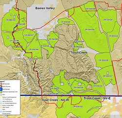
The map above is a cropped version. Here is the complete map with legend.
- Willow Creek
Inventory Units
If a Wilderness Inventory Unit is not yet listed, those findings have yet to be completed and will be posted in the future.
- OR-034-082 Poison Creek - All
- OR-034-083 Cottonwood Mtn - All
- OR-034-085 Hope Butte - All
- OR-034-102 McCarthy Ridge - All
- OR-034-103 Striped Mountain - All
- OR-034-109 Thorn Flat - All
Willow Creek GMA Map
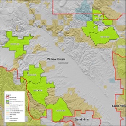
The map above is a cropped version. Here is the complete map with legend.

