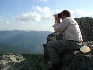
Table Rock Wilderness
Trail systems in the Wilderness were significantly impacted by recent fire activity, so not all trails are passable, especially at higher elevations. We advise turning around if the trail becomes difficult to follow due to down trees and brush. For additional fire closures and restrictions within the Northwest Oregon District, visit https://www.blm.gov/programs/public-safety-and-fire/fire-and-aviation/regional-info/oregon-washington/fire-restrictions for more information and closure maps.
The United States Congress designated the Table Rock Wilderness in 1984 and it now has over 5,786 acres. All of this wilderness is located in Oregon and is managed by the Bureau of Land Management (BLM).
A remnant of a lava flow that once covered this region along the western foothills of the Cascades, the "fortress" of Table Rock stands at 4,881 feet above the northeastern portion of this small Wilderness. On this steep and rugged terrain you'll find a quiet forest of Douglas fir and western hemlock, with noble fir at higher elevations and crowds of rhododendron on many of the upper slopes, an island of old growth in an ocean of forest development. At least two endangered plants bloom here: Oregon sullivantia and Gorman's aster. Deer and elk wander about in winter, and the northern spotted owl has been spotted among the old trees.
Leave No Trace principles:
- Plan Ahead and Prepare
- Travel and Camp on Durable Surfaces
- Dispose of Waste Properly
- Leave What You Find
- Minimize Campfire Impacts
- Respect Wildlife
- Be Considerate of Other Visitors
Regulations:
Motorized equipment and equipment used for mechanical transport are generally prohibited on all federal lands designated as wilderness. This includes the use of motor vehicles (including OHVs), motorboats, motorized equipment, bicycles, hang gliders, wagons, carts, portage wheels, and the landing of aircraft including helicopters, unless provided for in specific legislation. In a few areas some exceptions allowing the use of motorized equipment or mechanical transport are described in the special regulations in effect for a specific area. Contact the agency for more information about regulations.
Photos
Phone
Activities
Addresses
Geographic Coordinates
Directions
To reach Table Rock Wilderness, located 19 miles southeast of Molalla, Oregon take the Woodburn exit from Interstate 5. Travel east on Highway 211 to Molalla. From the east end of Molalla follow signs to Feyrer Park. From Feyrer Park turn right on South Dickie Prairie Road. Travel on South Dickie Prairie Road to the bridge at Glen Avon. Cross the bridge, turn left and travel south 12 miles on South Molalla Road to the junction of Middle Fork and Copper Creek roads. A right turn leads to the Old Bridge Trailhead, immediately across the bridge. A left turn leads to the Table Rock Trailhead.
Fees
No fees.


