Devil's Garden
PLAN YOUR VISIT
- Monument Home
- Safety and Conditions
- Know Before You Go
- Road Report
- Visitor Centers
- Outfitters and Guides
- SRP Application Guidance
- Kanab Field Office
- Leave No Trace
- Interactive Map
- GSENM Geo-Referenced Map
- Burr Trail Scenic Byway
- Cottonwood Road
- Lower Calf Creek Falls
- Hole in the Rock Scenic Backway
- Skutumpah/ Johnson Canyon Roads
Active Advisories & Alerts in Effect
Check out the advisories and alerts in effect to help plan and prepare for your next adventure.
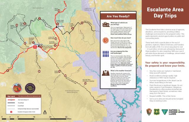
Cool Day Trips in the Escalante Area
Phone
Geographic Coordinates
Directions
The main access to the Devils Garden is the Hole-in-the-Rock Road, which begins about five miles east of the city of Escalante at the Scenic Byway 12 intersection. A sign marking "Devil's Garden" is located 12 miles along the unpaved road, and to the right is a dirt road leading to the Devils Garden.


