
Carrizo Plain National Monument
All vehicles including UTVs on the monument must be street-legal (DMV plated) and all vehicles must stay on roads.
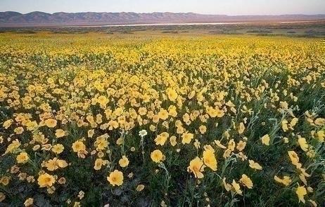
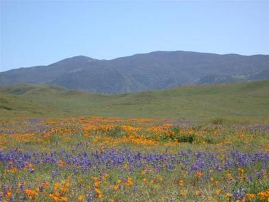
2025 Wild Flowers
Click here for more information on the latest 2025 wildflower conditions
REMINDER: Please follow warning signs and respect private property when visiting your public lands. This is a remote area with limited towing services, no fuel, food or water nearby.
ROADS: Rain showers continue, please be cautious on dirt roads! Don't drive into the flowers, park alongside the road (parallel) as not to obstruct other traffic and watch for pedestrians. Currently Simmler Road and Panorama Road are open. High clearance vehicles are recommended, especially in muddy areas. Soda Lake Road and Elkhorn Road are also open.
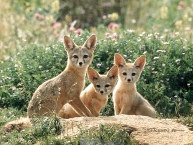
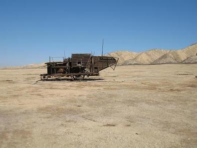
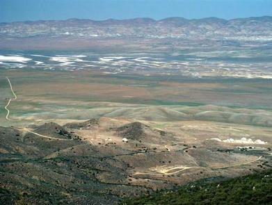
Overview The Carrizo Plain National Monument, located 100 airline miles (160 km) from Los Angeles, is an area by-passed by time. Soda Lake, its centerpiece, is a glistening bed of white salt, set within a vast open grassland, rimmed by steep mountains. The plain is home to diverse communities of wildlife and plant species, is an area culturally important to Native Americans, and is traversed by the San Andreas fault, which has created and moved mountain ranges, carved valleys and is marked by a subtle alignment of ridges, ravines and pools.
Goodwin Education Center
Phone: 805-475-2131
Open: December 1 - May 31.
Hours: 9:00 a.m. - 4:00 p.m., Thursday - Sunday
Maps and brochures are available at the front door when the center is closed. Wheelchair accessible restrooms at the Education Center remain open 24 hours a day, seven days a week, throughout the year.
Contact the Education Center or make it your first stop to receive updated information about your visit to the Carrizo Plain National Monument.
Get permits for Guided and Self-Guided Tours
Download the Carrizo Plain National Monument Recreation Map and Guide
Special Rules for the Carrizo Plain
Please observe the following rules during your visit to the Carrizo Plain National Monument.
Painted Rock Exclusion Zone: The following items/activities are not allowed in the Painted Rock Exclusion Zone: Horses and dogs, non-motorized bicycles (except the Painted Rock parking area), cache-type activities (geocaching, earth caching, etc.), discharge of firearms, and campfires.
Pictographs and Petroglyphs: The making of digital, photographic, print, or video images of any of the pictographs or petroglyphs, or any graffiti that overlies or is adjacent to, for commercial use is not allowed.
Weapons: Recreational target shooting is prohibited within the entire monument. Public lands within 1/4 mile of any campground, Painted Rock, facility (including the Washburn, Saucito, and MU ranch headquarters), developed overlooks, interpretive sites or pullouts, are closed to the discharge of firearms. Use of replica weapons (such as paintball, airsoft, or war game apparatus is not allowed on the monument. In addition, there is a No Shooting Zone established/marked around Painted Rock and the Goodwin Education Center.
Access: All public lands within 1/4 mile of Sulphur Springs are closed to public access, in order to protect sensitive resources. All public lands within 1/4 mile of Painted Rock are closed to public access from March 1 through July 15 each year, except for tours authorized by the Bureau of Land Management, for the same reason.
Photos
Activities


Addresses
Geographic Coordinates
Directions
Carrizo Plain National Monument is west of Bakersfield, California.
This area is very remote and undeveloped, therefore it is recommended that you do not rely on GPS or other mapping programs to lead you to the park. All vehicles must remain on roads.