


Arizona Fire Program
The Bureau of Land Management (BLM) is responsible for 12.1 million acres of public lands across Arizona. The BLM coordinates with the U.S. Wildland Fire Service (USWFS) for fire protection on BLM lands in Arizona.
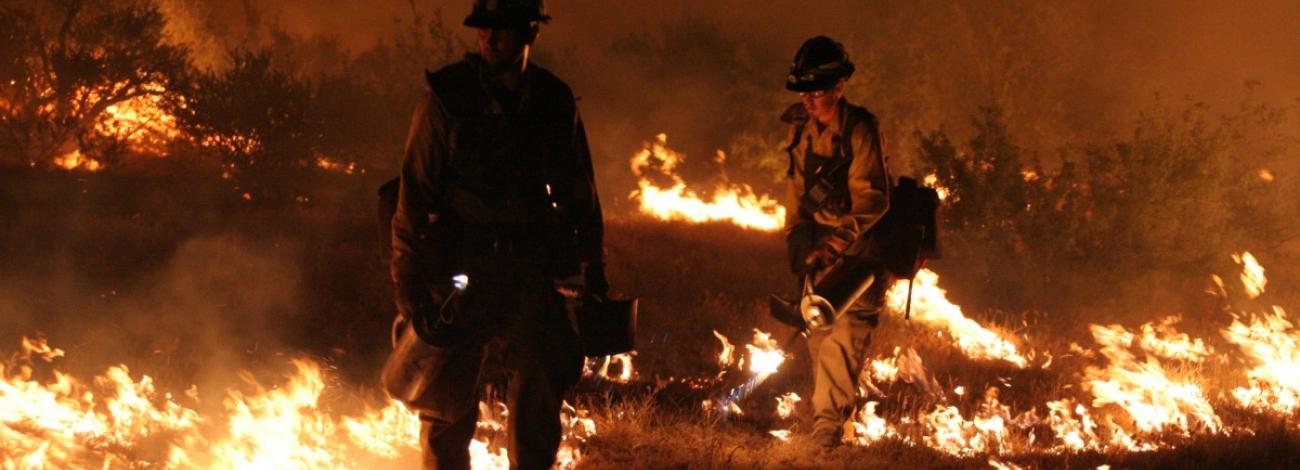
Professional USWFS fire management staff provides wildland firefighting for protection of natural resources, as well as using fire as a tool to improve the health of the land. In addition to fire protection, the USWFS assists the BLM with the implementation of vegetation management treatments and hazardous fuels reduction projects in the wildland urban interface.
In fire management, the number one priority is firefighter and public safety. As a cooperator with other federal, state, and local agencies and firefighting departments, the USWFS assists its partners in wildland firefighting and all-hazard incidents such as earthquakes, floods, and hurricanes.



BLM cooperation with USWFS
The USWFS provides the following support to the BLM:
- Wildland Fire Operations
- Aviation
- Fuels Management
- Fire Mitigation and Community Assistance
- Fire Prevention and Education
- Fire Investigation and Trespass
Fire Response to BLM Districts
Each BLM District receives both initial and extended attack support through dispatch offices staffed by an interagency team of professionals. Every district receives support from U.S. Wildland Fire Service personnel.
Arizona includes the following Districts:
- Arizona Strip District
- Arizona Strip Field Office and Grand Canyon-Parashant National Monument
- Colorado River District
- Kingman, Lake Havasu, and Yuma field offices
- Gila District
- Safford and Tucson field offices
- Phoenix District
- Hassayampa and Lower Sonoran field office
With the exception of the Arizona Strip District which operates in the USWFS Great Basin Geographic Area , all other BLM Arizona Districts are within the USWFS Southwest Geographic Area.
Information on dispatch operations in the Southwest Area can be found on the Southwest Area Coordination Center web site. The Arizona Strip District operates within the Great Basin Coordination Center.
Each district is supported by an interagency dispatch center.
When a fire exceeds initial attack capabilities, the dispatch offices place orders for additional fire resources to the appropriate coordination center.
Arizona Strip District [AZ-ASD]
More than 2.7 million acres of BLM-administered public lands lie within the area known as the “Arizona Strip,” located in the northern portions of Coconino and Mohave counties, north and west of the Colorado River.
There is a broad range of resource issues involving fire within this region, including:
- vegetation classification;
- various management considerations for fighting fires in areas such as wilderness, desert tortoise habitat and grazing areas;
- access to remote locations;
- understanding the resources values to be protected; and,
- the overall management objectives for the environment.
The fire season on the Arizona Strip usually runs from May through early October, with the number of fires peaking in June and July. Lightning is the most common cause of fires, accounting for about 81 percent of all fires burning 96 percent of the total acres. Nearly 90 percent of these fires burn less than 10 acres, and less than two percent consumed more than 1,000 acres.
- Contact Information
Office: 435-688-3200
Dispatch: 435-865-4600 or
Report a Wildfire: 435-865-4611
Dispatch Website: Color Country Interagency Fire Center
Colorado River District [AZ-CRD]
BLM's Colorado River District encompasses the Kingman, Lake Havasu, and Yuma field offices.
The vegetation in this management unit is dominated by desert shrubs, trees, and cacti. Deep upland sites have overstories of mesquite, palo verde, and ironwood, with understories of perennial and annual grasses and forbs. In the higher elevation of the Hualapai Mountains, pinyon and ponderosa pines dominate the landscape, while the Colorado River corridor is comprised of salt cedar, willows, cottonwoods, and other riparian vegetation.
About 98 percent of fires in this area are human caused and generally occur between February and October. Most of these fires occur near main travel corridors and rivers. The 20-year annual average for all fire causes equates to 36 fires per year, burning an average of 3,000 acres per year.
- Contact Information
Offices:
- Colorado River District/Lake Havasu Field Office: 928-505-1200
- Kingman Field Office: 928-718-3700
- Yuma Field Office: 928-317-3200
Dispatch: 928-777-5700 (24 hours)
Dispatch Website: Prescott Interagency Fire Center
Gila District [AZ-GID]
Arizona’s Gila District contains about 2.4 million acres and covers the Tucson, Safford, and San Pedro Project offices.
The District sees an average of 27 fires each year on BLM public lands, with about 3,000 acres consumed per year. A typical fire season runs March through September. Lightning strikes cause 60 percent of the fires that occur within the area.
- Contact Information
Offices:
- Gila District/Tucson Field Office: 520-258-7200
- Safford Field Office: 928-348-4400
Dispatch: 520-202-2710 (24 hours)
Dispatch Website: Tucson Interagency Fire Center
Phoenix District [AZ-PHD]
The Phoenix District includes the BLM’s Hassayampa and Lower Sonoran field offices, nearly 2.4 million acres of BLM public lands and an additional 1.1 million acres within the Barry M. Goldwater Air Force Training Range.
There are many fuel types within this region, including the Sonoran Desert ecosystem, grasslands, desert oak/chaparral with intermixed manzanita, desert shrub and ponderosa pine. Fire season usually begins in mid-March and ends in early September, with an annual average of 61 wildfires, burning an average of 9,000 acres of BLM public lands each year.
- Contact Information
Office: 602-867-5400
Dispatch: 928-777-5700 (24 hours)
Dispatch Website: Prescott Interagency Fire Center