An official website of the United States government
Here’s how you know
Official websites use .gov
A .gov website belongs to an official government organization in the United States.
Secure .gov websites use HTTPS
A lock (
) or https:// means you’ve safely connected to the .gov website. Share sensitive information only on official, secure websites.
America’s public lands offer some of the most spectacular and interesting places you’ll ever see. While everyone is encouraged to stay at home, the BLM Blog will feature "Armchair Adventures." This is your opportunity to travel virtually and learn a bit about these amazing places. Today, follow along with the seventh installment of Armchair Adventures.
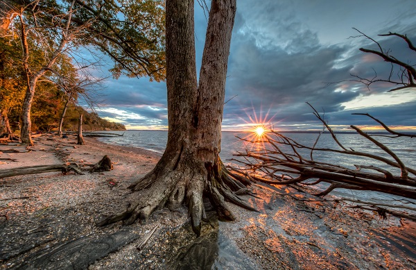
Douglas Point, Maryland
Only 40 miles south of our nation’s capitol, Douglas Point includes one of the few remaining undeveloped tracts of land along the Potomac River. Although timber was harvested here long ago, the presence of large trees and layers of shrubs and understory plants show that the area is once again developing into an old-growth forest, providing a wide variety of nesting and feeding areas for wildlife. Magnificent stands of white and chestnut oak support many species of birds that only nest in these mature forest areas, including wood thrush, worm-eating and hooded warblers, and whip-poor-will.
In spring, the forest is filled with blooming wildflowers and the songs of birds. Along the river, bald eagles can be seen circling overhead or chasing an osprey passing by with a fish in its talons.
Evidence of former inhabitants from both ancient and more recent times can still be found along the Potomac shoreline. When a warm sea covered the area over 60 million years ago, the remains of clams, sharks, rays, crocodiles, and turtles were deposited in the Aquia geological formation. Natural erosion of the river-bank exposes these remains, and ancient shells and shark's teeth are sometimes visible here on the shoreline.
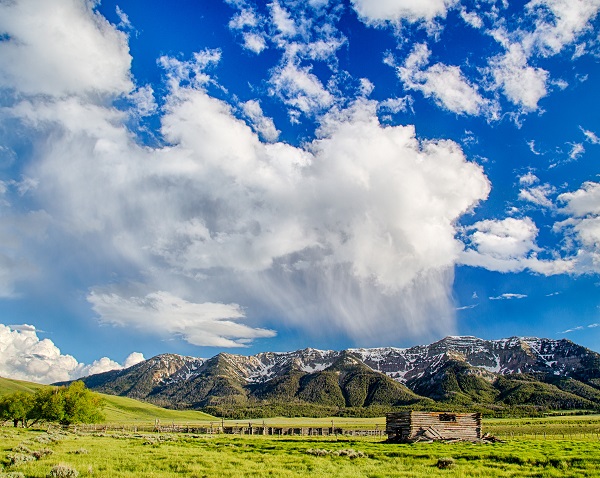
Centennial Mountains, Montana
The Centennials are one of the few east-west trending mountain ranges in the Rockies and serve as an important corridor for migrating animals. Yellowstone, Glacier, the Sawtooths and the Tetons all owe aspects of their current ecosystems to this range as a migration path linking the greater Yellowstone area to other parts of the Northern Rockies. The Centennials contain some of southwest Montana’s wildest country.
Moose, elk, deer, wolverines, badgers, black bears, a wide variety of birds, and occasionally wolves and grizzly bears use the range. A variety of waterfowl, including trumpeter swans, can be found on the adjoining Red Rock Lakes National Wildlife Refuge.
The north slope of the Centennials shown here, rises abruptly 3,000 feet above the Centennial Valley. About 60 miles of the 3,100-mile Continental Divide National Scenic Trail runs along the top of the range.
Red Rock Canyon, Nevada
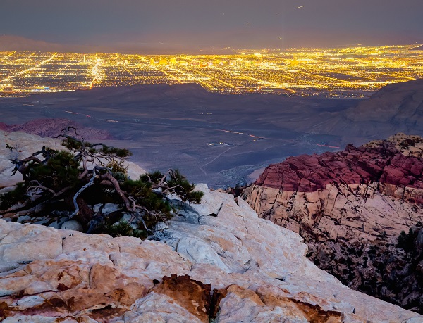
A twisted ponderosa pine clings to the orange-red Aztec sandstone cliffs in the waning evening light on the top of an unnamed peak in Red Rock Canyon National Conservation Area. Just 10 miles to the east and 5,000 vertical feet below, the bright lights of Las Vegas are a stark contrast to this windswept perch. Most visitors to Red Rock Canyon view its towering namesake cliffs from the scenic loop road and hiking trails at the base of the peaks. The climate in lower elevations is much warmer and drier than the mountaintops and is home to classic Mojave Desert plants and animals. Wildlife include desert tortoise, bighorn sheep and chuckwalla lizards while plants include prickly pear cactus, yucca and Joshua trees.
The massive frock formations of Red Rock were once sand dunes and other wind and water deposited sediments that solidified through a geologic process called lithification. A close look at the formations will revel many layers from once shifting sands that are now cemented in place.
The La Madre Mountains in the western and northern parts of the NCA are made up of older gray limestone which resting on top of the younger red sandstone. This is a result of the forces of the Keystone Thrust Fault, a landform that extends to Canada but is in its most prominent textbook form here at Red Rock.