
Campfire Restrictions Decrease to Stage 1 on Wild Portion of Lower Rogue River
Southwest Ore—Due to a recent precipitation and an extended forecast that indicates cooler and moister conditions, officials with the Rogue River-Siskiyou National Forest, the Oregon Department of Forestry Southwest Oregon District and the Bureau of Land Management Medford District, have elected to further decrease campfire restrictions on those lands located within the boundaries of the Wild section of the Rogue National Wild and Scenic River. The Wild section flows from Grave Creek to the mouth of Watson Creek.
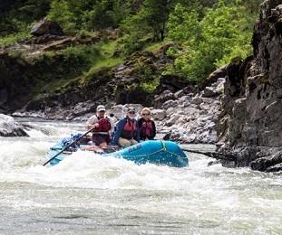
Effective 12:01 a.m. on Friday, October 18, 2024, campfires are allowed in fire pans below the high-water mark from Marial downstream to the mouth of Watson Creek. All ashes must be carried out. Additionally, smoking is only permitted while on watercraft on waterways, or in areas that are on vegetation-free sand and gravel bars located between the river and ordinary high-water mark.
The BLM administers the stretch of the river between Grave Creek and Marial, where ODF Southwest provides initial attack for new fires. The Forest Service manages from Marial and downriver to the mouth of Watson Creek. These restrictions will be in place through November 30, 2024, unless rescinded sooner. See the Forest Service order at https://www.fs.usda.gov/Internet/FSE_DOCUMENTS/fseprd1210697.pdf and the BLM Fire Restrictions Page for more information.
In addition, the Rogue River-Siskiyou National Forest will be moving to “Low” Fire Danger, rescinding all general forest fire restrictions and allowing campfires in dispersed campsites while remaining at Industrial Fire Precaution Level 1 starting at 12:01 a.m. on Friday, October 18, 2024.
For more information and to see the full text of the orders, see the RRSNF and BLM websites.
- The RRSNF Alerts and Notices page
- The BLM OR/WA Fire Restrictions Page
- Region 6 Interactive Fire Closure Map
- Follow the BLM, RRSNF and ODF on Facebook; and
- The SW Oregon ODF blog.
The BLM manages more than 245 million acres of public land located primarily in 12 western states, including Alaska, on behalf of the American people. The BLM also administers 700 million acres of sub-surface mineral estate throughout the nation. Our mission is to sustain the health, diversity, and productivity of America’s public lands for the use and enjoyment of present and future generations.